The Ciénaga Grande de Santa Marta: A Resilient Ecosystem
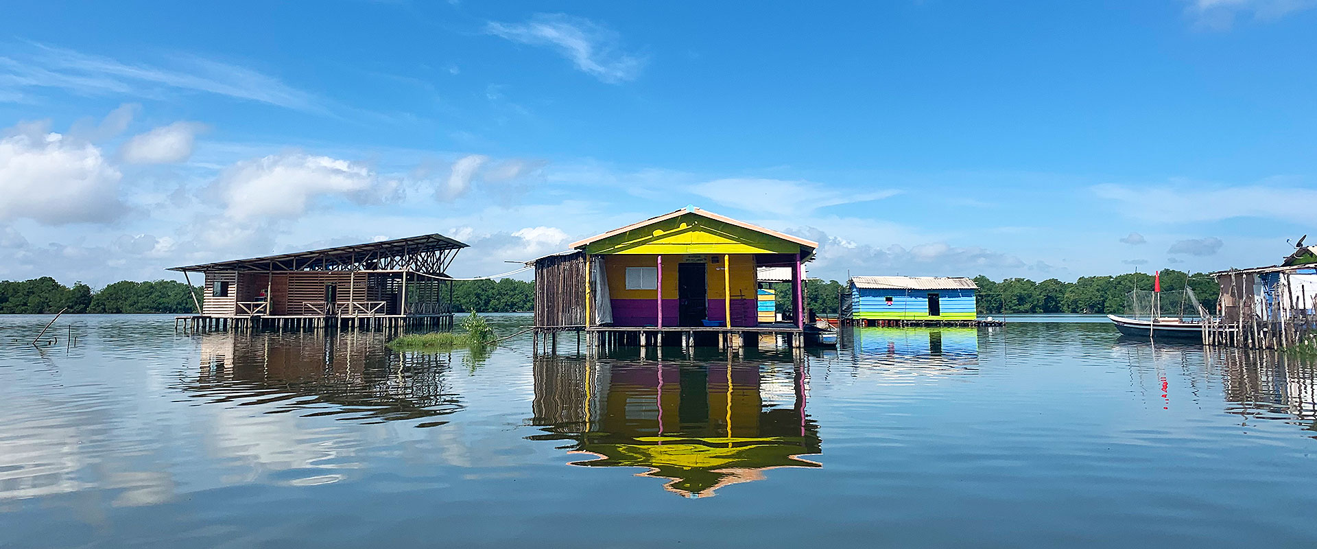
The history of the Ciénaga Grande de Santa Marta unfolds as a tale of two eras, marked by the construction of the road linking Santa Marta to Barranquilla. Prior to this transformation, spanning from the 19th to the mid-20th century, the Ciénaga Grande de Santa Marta was a sprawling expanse of mangrove forests, offering a haven and sanctuary for diverse marine and riverine aquatic life. This unique ecosystem stood at the confluence of waters from the Magdalena River and the Sierra Nevada de Santa Marta’s various rivers, mingling with the Caribbean Sea. With robust currents oxygenating the waters, it nurtured an array of species, from deep-sea marine creatures to riverine dwellers that thrived in the mangroves and stilted settlements of Buenavista, Bocas de Cataca, and Nueva Venecia. However, the 1950s marked a pivotal moment in the history of the Ciénaga Grande. The construction of the road blocked the natural flow of water from the swamp to the Caribbean Sea, triggering a chain reaction of consequences. Increased evaporation, oxygen depletion, heightened salinity levels, and ensuing ecological disturbances left an indelible mark. This shift not only led to the decline of mangroves and fish populations but also bore profound social and economic impacts—perhaps the most significant environmental challenge Colombia has ever faced. The full scope of this road’s negative effects, encompassing ecological, social, economic, and even spiritual dimensions (as a sacred site for the indigenous peoples of the Sierra Nevada de Santa Marta), is yet to be fully comprehended. To underscore the gravity of the situation, consider these two stark examples: first, in 1956, before the road’s construction, the mangrove area spanned 51,150 hectares, but by 1995, it had dwindled to a mere 17,760 hectares—a staggering 65% loss of coverage. Second, in 1967, the swamp yielded 27,000 tons of fishery resources; fast forward to 1987, and that number had plummeted to a mere 1,785 tons. These figures alone underscore the profound impact of a seemingly innocuous two-lane, 60-kilometer road.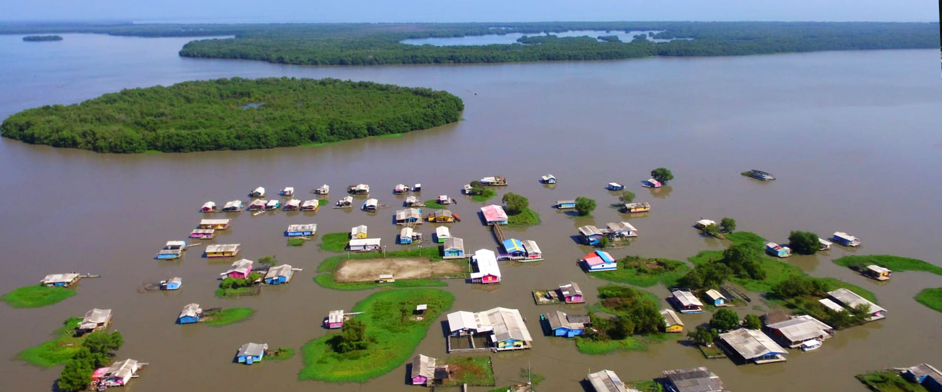
Another dark chapter in the lives of Ciénaga Grande de Santa Marta’s families was the tragic massacre of Nueva Venecia in 2000. Seventy paramilitaries, suspecting the locals of aiding guerrillas, took violent actions to assert territorial control, leading to the brutal killing of fifteen fishermen. They later targeted Buenavista, claiming the lives of twelve more. Though reports vary, with some suggesting up to fifty victims, the terror and trauma endured by the families forced many to displace to Tasajera, Sitio Nuevo, Barranquilla, and neighboring communities. While some families eventually returned, the memory of this harrowing event continues to haunt the community’s collective memory.
Despite these adversities, this unique amphibious territory boasts a silver lining. It has garnered the support of governmental, academic, and non-governmental organizations that have initiated social and environmental projects aimed at restoring this colossal coastal water body, spanning 45,000 hectares. The efforts to protect it have taken a multi-pronged approach, involving both national and international legal measures, such as:
- Ramsar Zone Designation (1998): As a Ramsar-designated area, it has gained a framework for coordinated actions and international cooperation to promote its preservation.
- Sanctuary of Flora and Fauna (Since 1977): Recognized as a sanctuary for the region’s rich biodiversity.
- Exclusive Reserve Zone (Since 1978): Serving as a planning tool for local artisanal fishermen and the conservation of economically and ecologically vital species.
- UNESCO Biosphere Reserve (Since 2000): Acknowledged for its commitment to conserving species and the genetic diversity of the ecosystem for educational and scientific purposes.
- Isla de Salamanca National Natural Park (Since 1964): Among Colombia’s earliest protected areas, dedicated to preserving its ecological treasures.
